


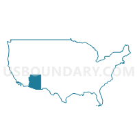
Cochise & Santa Cruz Counties--Sierra Vista City PUMA, Arizona
About
Outline

Summary
| Unique Area Identifier | 192171 |
| Name | Cochise & Santa Cruz Counties--Sierra Vista City PUMA |
| State | Arizona |
| Area (square miles) | 7,456.70 |
| Land Area (square miles) | 7,402.61 |
| Water Area (square miles) | 54.10 |
| % of Land Area | 99.27 |
| % of Water Area | 0.73 |
| Latitude of the Internal Point | 31.82431110 |
| Longtitude of the Internal Point | -109.92604730 |
Maps

Graphs
Select a template below for downloading or customizing gragh for Cochise & Santa Cruz Counties--Sierra Vista City PUMA, Arizona


Neighbors
Neighoring Public Use Microdata Area (by Name) Neighboring Public Use Microdata Area on the Map
- Gila, Graham, Greenlee & Pinal (East) Counties PUMA, AZ
- Pima County (Northeast) PUMA, AZ
- Pima County (Southeast)--Tucson City (Far Southeast) & Sahuarita Town PUMA, AZ
- Pima County (West) PUMA, AZ
- Southwest New Mexico PUMA, NM
Top 10 Neighboring County (by Population) Neighboring County on the Map
- Pima County, AZ (980,263)
- Cochise County, AZ (131,346)
- Santa Cruz County, AZ (47,420)
- Graham County, AZ (37,220)
- Greenlee County, AZ (8,437)
- Hidalgo County, NM (4,894)
Top 10 Neighboring County Subdivision (by Population) Neighboring County Subdivision on the Map
- Tucson CCD, Pima County, AZ (853,603)
- Arivaca CCD, Pima County, AZ (81,534)
- Sierra Vista CCD, Cochise County, AZ (51,125)
- Nogales CCD, Santa Cruz County, AZ (44,207)
- Bisbee CCD, Cochise County, AZ (29,838)
- Safford CCD, Graham County, AZ (24,993)
- Douglas CCD, Cochise County, AZ (19,772)
- Benson CCD, Cochise County, AZ (12,520)
- Willcox CCD, Cochise County, AZ (10,469)
- Elfrida CCD, Cochise County, AZ (5,651)
Top 10 Neighboring Place (by Population) Neighboring Place on the Map
- Sierra Vista city, AZ (43,888)
- Nogales city, AZ (20,837)
- Rio Rico CDP, AZ (18,962)
- Douglas city, AZ (17,378)
- Sierra Vista Southeast CDP, AZ (14,797)
- Bisbee city, AZ (5,575)
- Benson city, AZ (5,105)
- Willcox city, AZ (3,757)
- Whetstone CDP, AZ (2,617)
- Huachuca City town, AZ (1,853)
Top 10 Neighboring Elementary School District (by Population) Neighboring Elementary School District on the Map
- Continental Elementary District, AZ (26,016)
- Palominas Elementary District, AZ (10,521)
- Solomon Elementary District, AZ (2,883)
- Pearce Elementary District, AZ (2,069)
- Sonoita Elementary District, AZ (1,849)
- Santa Cruz Elementary District, AZ (1,753)
- Patagonia Elementary District, AZ (1,533)
- Naco Elementary District, AZ (1,502)
- Bonita Elementary District, AZ (1,197)
- Elfrida Elementary District, AZ (1,121)
Top 10 Neighboring Secondary School District (by Population) Neighboring Secondary School District on the Map
Top 10 Neighboring Unified School District (by Population) Neighboring Unified School District on the Map
- School District Not Defined, AZ (69,809)
- Vail Unified District, AZ (52,532)
- Sierra Vista Unified District, AZ (48,962)
- Sahuarita Unified District, AZ (27,042)
- Nogales Unified District, AZ (22,183)
- Douglas Unified District, AZ (21,931)
- Santa Cruz Valley Unified District, AZ (20,089)
- Safford Unified District, AZ (16,677)
- Willcox Unified District, AZ (8,533)
- Benson Unified School District, AZ (8,210)
Top 10 Neighboring State Legislative District Lower Chamber (by Population) Neighboring State Legislative District Lower Chamber on the Map
- State House District 30, AZ (231,236)
- State House District 25, AZ (208,220)
- State House District 5, AZ (192,258)
- State House District 39, NM (22,945)
Top 10 Neighboring State Legislative District Upper Chamber (by Population) Neighboring State Legislative District Upper Chamber on the Map
- State Senate District 30, AZ (231,236)
- State Senate District 25, AZ (208,220)
- State Senate District 5, AZ (192,258)
- State Senate District 35, NM (39,691)
Top 10 Neighboring 111th Congressional District (by Population) Neighboring 111th Congressional District on the Map
- Congressional District 7, AZ (855,769)
- Congressional District 1, AZ (774,310)
- Congressional District 8, AZ (754,300)
- Congressional District 2, NM (663,956)
Top 10 Neighboring Census Tract (by Population) Neighboring Census Tract on the Map
- Census Tract 9661.04, Santa Cruz County, AZ (9,945)
- Census Tract 9661.05, Santa Cruz County, AZ (9,627)
- Census Tract 18, Cochise County, AZ (9,219)
- Census Tract 41.07, Pima County, AZ (8,521)
- Census Tract 19, Cochise County, AZ (7,083)
- Census Tract 5, Cochise County, AZ (5,651)
- Census Tract 13, Cochise County, AZ (5,613)
- Census Tract 41.09, Pima County, AZ (5,304)
- Census Tract 7, Cochise County, AZ (5,196)
- Census Tract 8, Cochise County, AZ (5,160)
Top 10 Neighboring 5-Digit ZIP Code Tabulation Area (by Population) Neighboring 5-Digit ZIP Code Tabulation Area on the Map
- 85635, AZ (34,727)
- 85621, AZ (23,054)
- 85614, AZ (21,895)
- 85641, AZ (21,753)
- 85546, AZ (19,677)
- 85648, AZ (19,080)
- 85607, AZ (18,925)
- 85650, AZ (15,279)
- 85643, AZ (9,810)
- 85602, AZ (9,464)